


“Mono Lake lies in a lifeless, treeless, hideous desert, eight thousand feet above the level of the sea, and is guarded by mountains two thousand feet higher, whose summits are always clothed in clouds. This solemn, silent, sail-less sea—this lonely tenant of the loneliest spot on earth—is little graced with the picturesque. It is an unpretending expanse of grayish water, about a hundred miles in circumference, with two islands in its centre, mere upheavals of rent and scorched and blistered lava, snowed over with gray banks and drifts of pumice-stone and ashes, the winding sheet of the dead volcano, whose vast crater the lake has seized upon and occupied.”
Mark Twain, Roughing It Chapter, 1872
If a place is worth going to, chances are, it’s worth going back. But even in a lifetime of adventure, there are still things we haven’t seen. The world doesn’t always seem that small when you’re driving or hiking and meandering down back roads.
Someone has always been there before. yesterday, or farther back. We’re not the first to walk out and look up and know there’s something special here—sometimes, there are a bunch of them right there with you. Sometimes, you’re all alone.
You can look at it one of two ways. You’re either all alone or enjoying the solitude. You’re either besieged by crowds or part of a community. It all depends on your point of view.
Mono Lake South Tufa
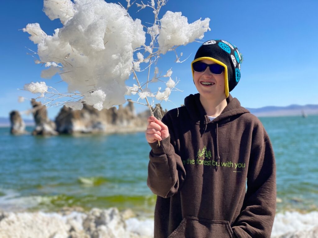
They say the United States is a country of rugged Non-Conforminsts, and that may or may not be true. But what is certainly true is that Mono Lake does not conform to the ideals that seem to govern what can be a beautiful mountain lake. But it’s nit lifeless as Mark Twain claimed, nor is it strictly treeless, if you can be flexible on what you call a tree. While you’re being flexible, notice the colors. Muted though they are, Mono Lake has a dazzling array of colors in the sky, the rock and the plant life that thrives in the strange and rugged basin.
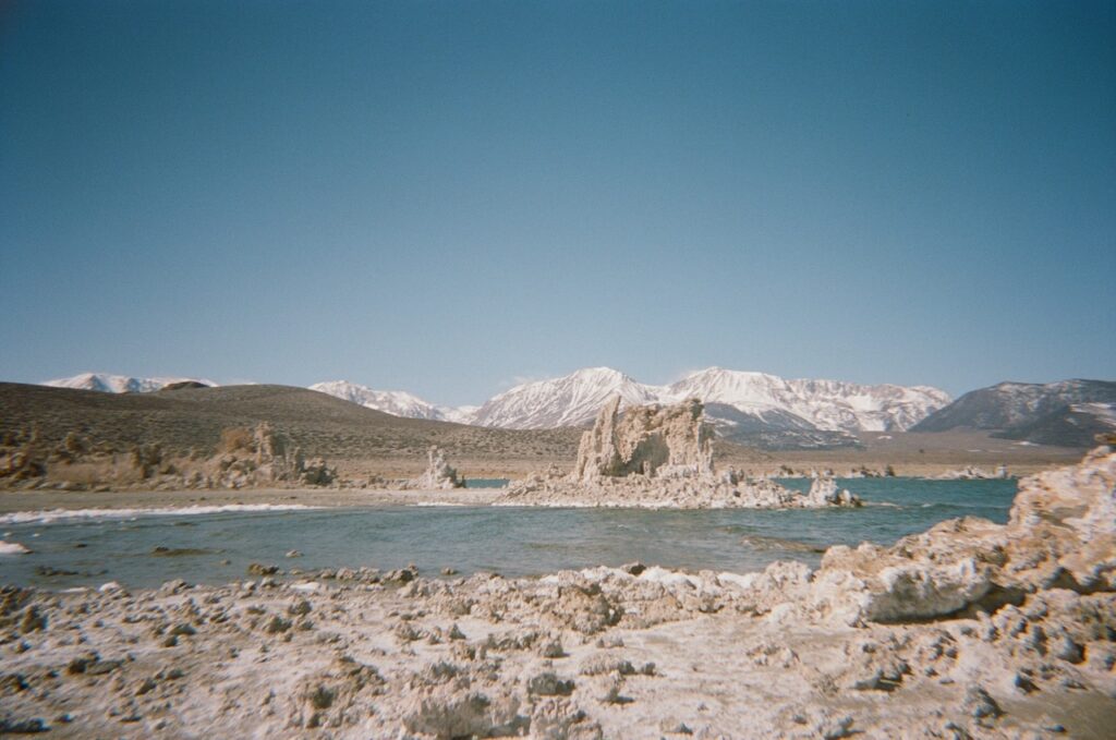
There are lots of things to see and explore around Mono Lake, but for this chapter, we’ll be checking out the South Tufa. We’ve been there before, but it’s definitely a place that is worth going back to. There is a day use fee required to park and visit here and you can pay that fee at a kiosk there in the parking lot. There are no campgrounds in the basin, but camping is allowed in certain areas around the lake. You can check this map here for info on where dispersed camping is allowed a certain distance away from the lake and most of the area is signed when it isn’t allowed.
A word about what I do and why
I get comments about how I tell people about places in the West that maybe aren’t widely known and that maybe I’m contributing to increased visitorship and the eventual “spoiling” of these favorite spots and that maybe I should stop. And to that, I have a few things to say.
First: these places aren’t secret. They’re on the map, they’re in countless guidebooks, blogs, and social media posts already and all it takes is for someone to look at a map, follow a sign, or happen to see a photo. If you like to go places and not say anything about it, great. But you’re not saving them from being spoiled so your grandchildren can see them, you’re just kicking the can down the road. Because when outsiders, or even locals, come across a place like that they think nobody knows about and thus, nobody cares. And they treat it as such.
Second, I’ve been told by multiple BLM personnel that my content is useful for them to understand how the public uses public land and informs their policy on how they should manage and maintain our access. So creating content about places on public land has value in keeping those places accessible.
But what about Alabama Hills? That place has no shortage of content, and now camping is prohibited in much of that area. You’ll see more about that in the next episode, but spoiler alert: it’s the poop.
Third: travel writing, travel guides, and writing about adventure have a long and loved tradition in modern media. It is an art that goes way, way back to the quote from 1872 the top the beginning from Mark Twain’s book, Roughing It. My main interest is in storytelling, and places and place names and how we get there and how we get home are indispensable components of storytelling.
A lot of us pour over maps to find cool places to go, but we also have guidebooks, and the web, we listen to stories and google place names we see or overhear in order to find the next cool place to go. Nobody is out there wandering the land finding things on their own with no help from technology or some other traveler who went before and told others what they saw. And we all set some bar of difficulty in route finding that we deem acceptable and then gatekeep adventure if others don’t live up to it.
Fourth: when we create content about places like Mono Lake, Lagomarsino petroglyphs or tunnel camp, a major focus of our efforts is in modeling good outdoor ethics and talking candidly about how to visit wild places while minimizing our impact there.
Chidago Canyon Petroglyphs
There’s more than one way to get anywhere. Usually, a long way, a short way, and an “I wouldn’t go that way.” We usually prefer the third option because it’s more fun. In the case of getting to the native american petroglyph sites in the Volcanic tablelands north of Bishop, Ca, the ultimate option is Chidago Canyon Road.
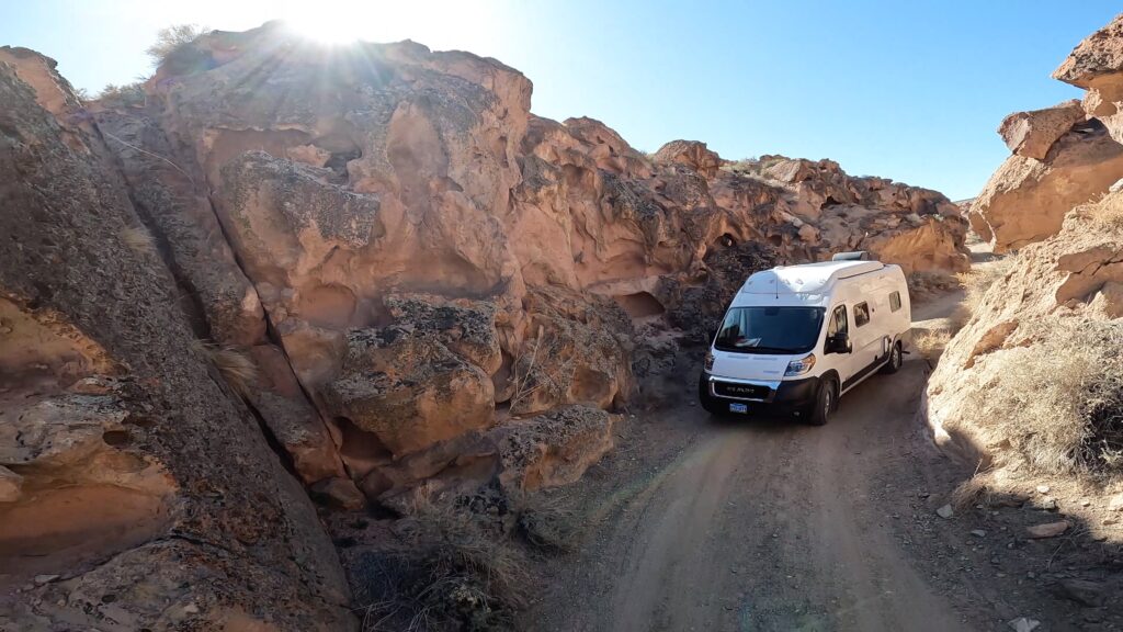
Chidago Canyon Road is an easy dirt road that, at one point, follows a wash through a tight but shallow canyon cut through volcanic tuff from the Long Valley Caldera in the Volcanic Table Lands just north of Bishop, CA. From US Highway 395 South past the Mammoth Lakes Exit, turn left on Benton Crossing Road then right on Chidago Canyon Road, then right on Fish Slough Road. It’s about 16.5 miles from the intersection with Benton Crossing Road.
Would we advise you to take a rented 2-wheel drive wagon with no spare tire on that road? We would not. Would we do it again? We sure would.
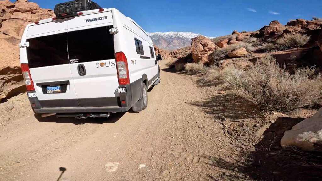
You can play it safe and bypass all that mess from a shorter, simpler dirt road to access this site from the south end of Fish Slough Road in Bishop. Playing it safe is a relative practice, though. Most things we worry about never happen anyway[Tom Petty], except the regret that inevitably follows missing out on something epically cool because you played it safe. Anyway, “Worry is dividend paid to disaster before it is due.” [Ian Flemming]
Once you get to the Chidago Canyon Petroglyph site, you’ll find a volcanic outcrop at the base of a butte decorated with petroglyphs and excluded by a split rail fence. you can scramble over the tuff talus to the top of the hill and take in the sweeping vistas there of the East side of the Sierra Nevada Mountains and the west face of the White Mountains. Please respect the site for what it is and be mindful of your impact on it. Not all have done so, but that doesn’t mean you have a pass.
We weren’t completely alone for our visit, but it also wasn’t super crowded. The kids took the camera around to be silly and shoot some footage for this video.
I definitely think we’ll go back to the places we visited that day. The landscape is changing there and everywhere we go, you can’t deny that. And we all leave our mark minimal though it may be. We might be alone. We might be besieged by crowds. With any luck though, we’ll find that community.
There are no services or facilities there. To get out head on down Fish Slough Road and into the town of Bishop, CA.
Happy Trails


Add comment