Mojave Preserve Adventure Part 1: The Mojave Road
[Route and Resources at the bottom. Click images for more info.]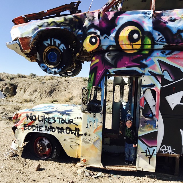
Rocket walked through the deserted cars eyes wide. There was an panel van sitting on it’s frame in the dry wash spray painted like psychedelic a ice cream truck derelict post apocalypse. A stretch limo, in matching livery sat atop it. Cars, and busses stuck out of the ground at odd angles. Up on the rim of the quarry a bus pointed to the sky from it’s geologic socket. It was likely as unclear to the 2 year old as it was to me, whether it was coming out or going in.
Goldfield, NV
The International Car Forest of the Last Church is off the highway in Goldfield Nevada, and is not quite half way between Reno, NV and the start of the Mojave Road. It’s also, coincidentally, on the cover of Via Magazine this month. It’s an art installation by Reno artist Chad Sorg, technically, but Goldfield is also about as far south as you can get from Burningman on a single tank of gas. I do not believe that is a coincidence.
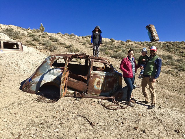
Still, if you’re 2 years old, or 7 (hell, 40) that kind of synchronicity is irrelevant, and it’s just a really cool place to stop for a few minutes on a long, long drive. We recommend it.
Mojave Road
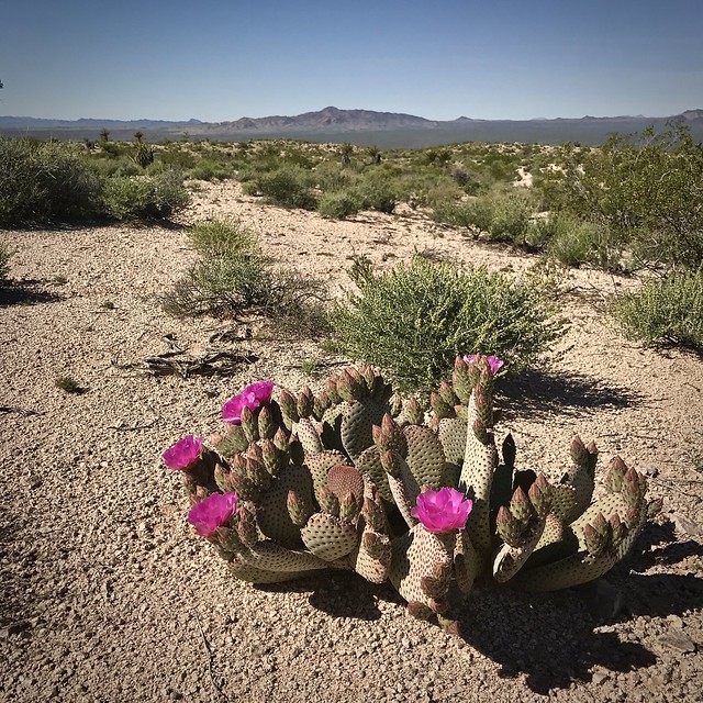
The Mojave road bisects the Mojave National Preserve and we picked it up where it crosses the Needles highway just south of Laughlin Nevada. The access point is a broad dry wash that is well traveled and fairly easy to find.
We were there right when the Overland Bound group was packing up to start in on the trail, but we got the jump on them and since we made a diversion the second day in, we never ran into them again.
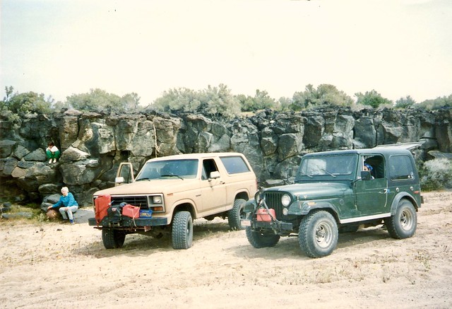
This is not our first time on the mojave road. Long before we learned the word “overlanding,” My dad and I strapped gas cans to our bumpers and drove the whole length of the road in the spring of 1995. Back then, the nascent National Preserve was not as well traveled as it is today and we spent a lot of time, if not lost, then wondering if we were lost, which is kind of the same thing, when no one else is coming down the road.
We dragged my sisters along with us on the 2 day excursion through the desert and we were also joined by my grandmother, Rosemary.
Route Finding
Today, the trail is marked with signs and carsonites occasionally, but always with cairns that are easy to spot. The availability of a GPS track makes it that much easier, to the point that, it might be nice to get rid of any physical markings altogether for a more natural feel.
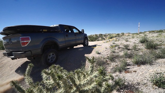
We are traveling in out new-to-us, and unmodified, Ford F-150 Supercrew with the FX4 package. This truck’s call sign is Icthyosaur. So named as it resembles the pre-historic, aquatic reptile in both size and color. It’s also the official state fossil of Nevada and is the name of the first State Park we visited in 2000 when we moved to Reno.
The Ichthyosaur did well on the road standing in for our 1999 4Runner admirably, with only the occasional scrape of the skid plates and tight squeeze through Joshua Trees.
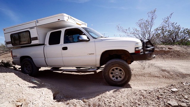
My parents joined us in their 2001 Chevrolet Silverado hauling a 2015 Four Wheel Camper, Hawk model. His truck has a significant lift and 33 inch tires, and also has a substantially shorter wheelbase than our truck. Still, he had more trouble getting through some of the Joshua Tree tunnels.
While the guidebook suggests that travelers will want to use 4-wheel-drive continuously on the road, we did not find that necessary. After a few dozen miles we left it in 2-high except for the occasional rutted wash that required full traction.
The Outpost at Piute Creek
One of the first interesting things you come to on the road is the historic site of The Outpost at Piute Creek. This time of year it is a beautiful place alive with blooming cactus and brush, as green as it ever gets. The creek was wet and audible in the channel below the fort and animals skitter across the desert pavement and rustle in among the dry fronds of the yucca plants.
It’s known as Ft. Piute today, but it was never more than a redoubt, or temporary fortification to provide shelter for travelers on the Mojave Road from the understandably hostile natives.
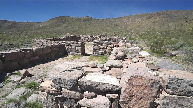
It was only manned by the army for a short time from 1866 – 1868 to protect travelers and secure the route for the mail. It was ravaged by the elements, and vandals over the years, but was rebuilt to it’s current state in 2005 by the National Parks Service.
The things you bring with you to places like Ft. Piute are the only clues to the time line you’re in. With clear horizons and forced silence from the omnipresent pest in your pocket, it’s easy to stop and enjoy the simple peace of a place like this.
Road Closure
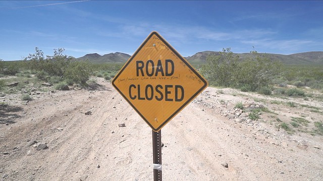
At the time we passed through, there was a road closure at the boundary of the Preserve where the road crosses through the Piute Range. The sign blocking the road said that medium to short wheelbase vehicles were OK. With two full size trucks we chose to take the detour. The Tom Harrison map, as well as the sections I downloaded to the Hema App showed what looked like a good route around to the south, so we headed for it. It took us through some sandy washes tight with overgrown brush, but it did in fact see us through back to the Mojave Road without missing much of the trail.
Lanfair Valley
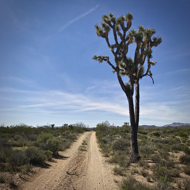
When we passed through here almost 25 years ago, this was the part of the road I found most impressive. Even in Joshua Tree National Park (then a monument) the specimens are neither as big or as numerous as they are between Piute Gorge and Rock Spring in the Mojave National Preserve. The Joshua Tree Forest in Lanfair leading up to Rock Spring is even more impressive today than I rememberd. At times we were creeping along threading in between the Joshua Trees with The Icthyosaur’s big ears pulled in.
Rock Spring
Just before the Mojave Road descends a steep, loose, gully beset with opposing pot holes into the wash, it crosses a well maintained, graded dirt road that seems to take you to the same place with no excitement. Down we went…
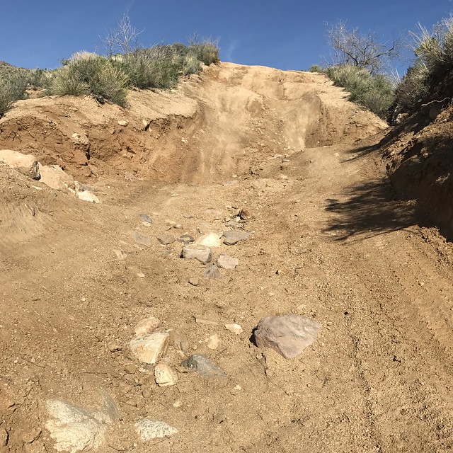
In the 4Runner I would have just rolled on down, no biggie. I’m still getting used to the way the Ford handles, though, so we set a spotter and took it slow. There was some scraping, but nothing serious. I was not super stoked with the gearing and traction of the Kelly tires. Something didn’t feel right. More on that in Part 2. The exit from this obstacle was your standard camber transfer that resulted in a high rear wheel lift that impressed my camera operator.
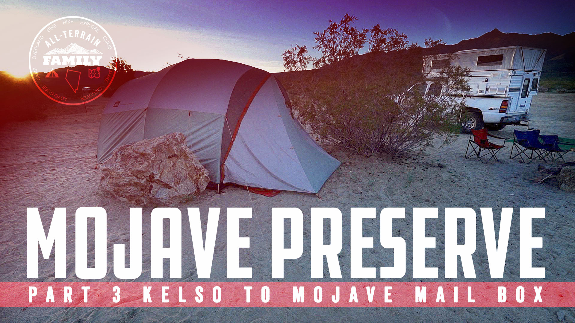
Dad had no trouble with this either and we were soon cresting the Mid Hills and scouting for a camp near the Rock House. We settled on the obvious site by a Pinyon Tree, set up camp and had a quick dinner. In the lingering evening we walked over to the Rock House.
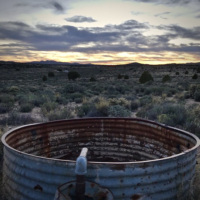
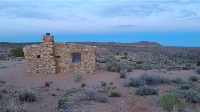
The Rock House is a fairly un-interesting attraction, above the abandoned Rock Spring camp. The boys checked and found three doors locked. Then proceeded to chant “Three Doors Locked” for the rest of the trip. This started up again when we screened the video. Not sure what’s up with that. Kids are weird.
The sun went down. The glow sticks came out and by and by, we zipped in to bed in the calm cool evening.
Part two—in which we divert to Hole In The Wall, see a desert tortoise, ascend Foshay Pass and batter dip the children in the 1 herbs and spices of Kelso Dune—is coming soon…
-M


Add comment