


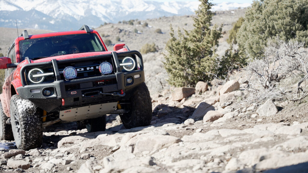
Reno is an amazing place to live if you love exploring dirt roads that provide access to public lands with amazing backcountry recreation, views and solitude. Here are ten easy off-road trails close to Reno, NV.
These trails are all well-traveled and easy to find, but if you want a little extra info, there are links below to writeups on allterrainfam.com and video guides on the All-Terrain Family YouTube Channel. For more info check out these books:
It’s also handy to have something like Gaia GPS (https://www.gaiagps.com) or On X Off Road (https://www.onxmaps.com) on your phone or tablet.
Alright, let’s hit the trail.
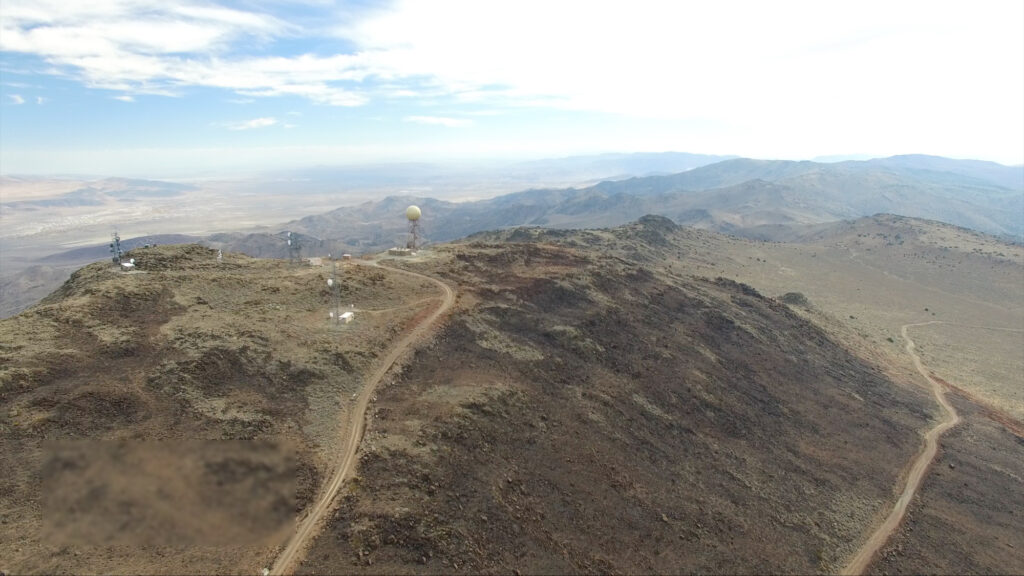
Peavine Peak: Easiest Off-Road Trail in the Reno Area
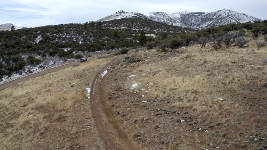
You see it every day, but did you know it’s super easy to get to the top? Peavine is probably the easiest dirt road you can do in the Reno area that actually goes somewhere. It’s rough but not particularly steep. It’s wide, with plenty of room to pass or turn around.
Despite the easy conditions, the views are great in every direction for most of the drive. If you’re into hiking or biking, you can access miles of single-track trails along the road. If you want to explore and make things more fun, there are endless side roads that are open to vehicle travel.
To get there, head north of Reno on I-580 to Stead Blvd. Turn left, then right on North Virginia St., then left on Peavine Road. The road turns to dirt right away and continues on to the summit, where there are radio towers and 360-degree views of the Truckee Meadows and the North Valleys.
The summit is about 7 miles from the turn-off at Virginia Street. This trip can be done easily in half a day. The road is impassable in winder as snow builds up and blocks travel. It can also be quite muddy in wet conditions.
- Mileage: 14
- Difficulty: 2 of 5
- Season: Summer through fall
- Map: Peavine Peak, Gaia GPS
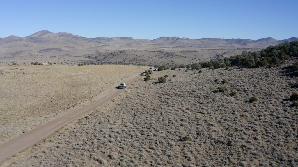
Sunrise Pass: Easiest Off-Road Trail in Carson City
Sunrise Pass road is the second easiest trail in this list and traverses the Pine Nut mountain range from Carson Valley to Smith Valley. Sunrise Pass road can be done as an out-and-back of any length or as part of a scenic loop around the Pine Nuts encompassing Smith Valley and Topaz Lake.
From Reno, travel south on I-580 through Carson City to Johnson Lane. Take Johnson Lane to the off-road staging area where the Sunrise Pass road begins. The road is dirt the whole way and gets rougher, rockier, and more rutted as you go higher and higher. Take care, and turn around if conditions exceed your comfort level.
Along the way, there are some sights like Painted Rock and spectacular views of the Carson Valley and Sierra Nevada Mountains. The Pine Nut Range is home to a great many Mustangs, and you’re likely to see bands of these horses on the lower flanks of the Sunrise Pass Road.
This road is also impassable in winter and could be affected by wet conditions.
- Mileage: 24
- Difficulty: 1
- Season: spring – fall
- Map: Sunrise Pass Gaia GPS, OnX Off Road
- Video: YouTube
- Blog Post: Visit Carson Valley
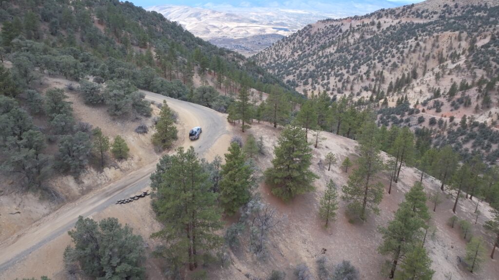
Dog Valley Road: Verdi Crystal Mine
Dog Valley Road and Hennessy Pass Road connect Verdi with the North Valleys around the West side of Peavine Peak. The main attraction of this trail is the Verdi Peak Crystal Mine. This is a spot that was a source of Quartz Crystals used in radios during World War 2. Just about any SUV can make this trip, from Subarus and AWD minivans to 4Runners or Suburbans, though this is a bit rougher at the start as you climb out of Verdi.
To get to this trail, head West out of Reno on I-80 to the Gold Ranch Exit. As you get off the freeway, turn left on Third Street, head back east to Verdi, and turn left on Bridge Street. After the one-lane bridge over the Truckee River, turn right on Dog Valley Road.
The road heads up the hill and becomes Henness Pass Road, which continues all the way to the Jackson Meadow area. Dog Valley is the valley behind Peavine, so when you come to an opening with views down into the valley, turn right on Dog Valley Road. From there, the road heads down into the valley and is labeled Long Valley Road on some maps. This can be slick and treacherous in winter, so take care here as well.
The Crystal Mine is about 9 miles from the start of Dog Valley Road. If you continue on the road, it winds through the forested valley that opens up and, after 18 miles, terminates at Highway 395 North of Reno.
- Mileage: 18 miles
- Difficulty: 2
- Season: All year, snow in winter
- Map: Gaia GPS
- Video: YouTube
- Blog Post: Verdi Crystal Mine
Toll Road: Historic Road from Reno to Virginia City
Toll Road is in my backyard. Most of the videos on this channel were shot in some part there on Toll Road. This is a Historic route from Reno to Virginia City and is maintained by volunteers and enthusiasts and, at the very bottom and top, by landowners who have houses there.
The road is generally passable all year as it doesn’t get much snow, but it does get a lot of traffic. From Reno, head south on I-580 to the South Virginia or Mt Rose exit. Follow signs for Virginia City, Geiger Grade Road, or Highway 341.
Turn right on Toll Road at the traffic light, and after 2.5 miles, you pass a barn with a “Foot of the Grade” sign, where it turns to dirt and starts up the hill. The road soon gets very rough and rutted. You’ll have to pick your way around the rocks and ruts, which are deep in spots. The road is plenty wide, and there are options for getting around most obstacles.
The paved Geiger Grade road is directly above for most of the way. At 4.5 miles, the road turns to the right and climbs out of the canyon on smoother but steeper terrain. At 5.68 miles, the road reaches Geiger Grade Road. From there, you can retrace your steps, head to Virginia City, head back down on the pavement, or link it up with Lousetown Road, Rocky Peak, or Jumbo Grade Road.
- Mileage: 5.7 Miles
- Difficulty: 3
- Season: All year, snow in winter
- Map: Gaia GPS
Virginia Peak: High Point of the Pah Rah Range
Virginia Peak is the high point of the Pan Rah range, which is the northern extension of the Virginia Range north of the Truckee River corridor. This is another easy dirt road with options to make it a little harder and more adventurous here and there. There are radio towers at the top here, as well as stunning views back towards Spanish Springs, Reno, and the Sierra Nevadas. The real treat is the views East down to Pyramid Lake, and Central Nevada on a clear day.
There are two ways to get to the top of Virginia Peal, and you can see them both in the maps in the description. Both Start off Whiskey Springs Road, which intersects with Pyramid Highway or NV 445 in Warm Springs Valley. The more difficult route follows Whiskey Springs Road and Paiute Creek Road And then Microwave Road.
The easier route follows Wilcox Ranch Road, Quaking Aspen Road and Microwave Road.
Microwave Road leads right to the summit and the radio towers. Other roads can get you away from the towers for better views and unobstructed photos. This trip should take you most of the day to get up and back, so pack a lunch.
- Mileage: 10 miles
- Difficulty: 2 – 3
- Season: Summer – Fall
- Map: Easy Route, Hard Route
Lousetown Road: Virginia Range Mustangs and Petroglyphs
Lousetown Road is another historic road that provides access to some remote areas of the Virginia Range. This road is the hardest so far and might require a vehicle that is more capable than average or a high sense of adventure or offroad driving skill. Some attractions on this trail are the many Virginia Range Mustangs you’re sure to see, mining ruins, and the Lagomarsino petroglyphs.
I want to stress the importance of treating the cultural sites in this area with the utmost respect for the history and legacy they represent. Do not damage, remove or disturb any historical or cultural sites or artifacts.
To access Lousetown Road, head up Geiger Grade Road to Lousetown Road and Turn Left. The road is paved for the first 4.8 miles, but it turns to dirt at the Fire Station. From there, it gets rough and rocky in some places. You’ll have to wind your way around rocks and ruts as it crosses back and forth over the creek bed. There is one section where it turns through a few switchbacks heading down a steep hill. This is the hardest part of the trail. Do not go down this if you aren’t certain you can make it back up.
At about 11 miles, you’ll find the road to the petroglyphs. Do not park on the native vegetation. If there is a lot of traffic and other cars, park at the intersection and walk in.
This area doesn’t get a ton of snow or wet weather so it’s usually passable all year.
- Mileage: 22
- Difficulty: 3
- Season: Year Round
- Map: Lousetow Road Gaia GPS
- Video: Petroglyphs
- Video: Petroglyphs and Bronco Canyon
- Lagomarsino Petroglyphs Blog post
- Bronco Canyon Blog Post
Jumbo Grade Road: The Long Way to Virginia City
Jumbo Grade Road is a special trail for us because it’s the first off-road trip we made as a family in our old 4Runner and the first video we made for this channel. At the time, we thought it was pretty extreme in our stock SUV, but it seems pretty tame to us now.
Jumbo Grade Road is a great, fun, adventurous way to get to Virginia City. It travels from Washoe Valley and East Lake BLVD all the way to the South end of Virginia City on C Street.
From Reno, take the old Carson Reno Highway south to East Lake Blvd and then continue to Jumbo Grade Road towards the south end of Washoe Valley. From there, the road passes through the neighborhood and turns to dirt, where it follows the creek up through the mountain. Follow the main route; it’s pretty obvious. Many obstacles exist, so be careful and turn back if you need to. Recent heavy winters have altered the trail a lot since we originally published our video.
The road tops out with great views both east and west. At that point, you can turn left and explore higher and eventually find the summit of Mt. Davidson, or continue onto Ophir Grade Road, which follows an easy road all the way down to Virginia City.
For an easier trip, drive the highway to Virginia City and take Ophir grade road to the pass and avoid all the harder 4-wheeling on Jumbo Grade.
- Mileage: 8
- Difficulty: 3
- Time: 4 hours
- Season: Year Round
- Map: Jumbo Grade Road Gaia GPS
- Video: Jumbo Grade Road
- Blog Post
Ophir Grade Road: Virginia Range 4 Wheeling
Ophir Grade Road is a harder variation of Jumbo Grade Road and starts from the intersection of Carson Reno Highway and East Lake BLVD. This road is rougher and has more rock obstacles than Jumbo, but it’s more fun and less traveled.
After You turn off onto East Lake Road, immediately take the dirt road to the left. Follow this past the house and into the canyon above. The road passes through a valley where you may see locals out shooting if you go on a weekend afternoon. You’ll reach an intersection where the route turns left. If you go straight, you’ll come to a place I call the Sand Trap. This is a random sand pocket where you can have some fun driving in the sand and trying to climb the hills. Don’t do this if you’re alone, as it’s deep sand, and you can easily find yourself stuck.
If you turn left, you’ll climb higher and higher through rocky terrain and scattered pinyon and juniper woodland. Nothing is all that hard, but if you don’t have much experience with this kind of driving, take it slow and use a spotter.
Eventually, the road turns south and connects with Jumbo Grade Road. You can either continue on the route for Jumbo or head down Jumbo and back to Washoe Valley.
- Mileage:7
- Difficulty: 2 hours
- Time: 3 hours
- Season: Year Round
- Map: Ophir Grade Road Gaia GPS
- Video: An interesting rock formation on Ophir Road, Nevada
Rocky Peak: 4Wheeling and Hiking
Rocky Peak is a tough, rocky, steep 4×4 track that heads up a remote part of the Virginia Range to a spot where you can hike the cool, craggy, and aptly named Rocky Peak. This one will be a challenge in a stock 4×4, but I believe it could be done if you know what you’re doing.
The trail begins off Six Mile Canyon Road. From Virginia City, head down Six Mile Canyon Road for 4.2 miles. The trail begins across from a turnout and passes under some power lines. The trial pretty much goes straight up the drainage over rocky terrain following an obvious road and the power lines.
Before gaining the summit the road gets steeper and rockier and switches back as it climbs. This is the hardest part of the road. When it tops out you’ll find a great spot for lunch with views of the Carson River Valley. You’ll see the pointed crag of rocky peak to the East. Leave your vehicle there and hike overland to the peak. That might take you an hour or 2 depending on how comfortable you are with overland hiking. There is no trail at all.
To get home, either head back down the way you came or head on, turning left at the first intersection and winding your way out to Long Valley Road. Turn left there, and you’ll end up back at Lousetown Road and HWY 341.
- Mileage: 7
- Difficulty: 4
- Time: 5 hours
- Season: Year Round
- Map: Rocky Prak Gaia GPS
- Video: Rocky Peak Trail, Virginia City, NV
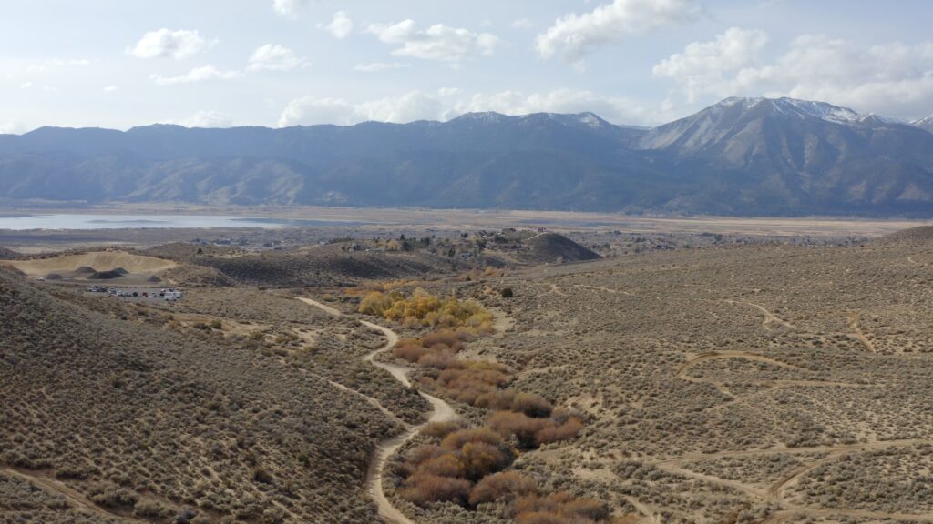
Hunter Lake Road
Hunter Lake Road is the hardest trail I’ve featured here and if we’re being precise, the only one that starts actually in Reno. This one can be done in a stock SUV, but it’s longer and more consistently challenging than the others featured here. It can be done as a LONG loop that will take most of the day or a shorter half-day out and back.
Begin this trail at the end of PineHaven Court near the intersection of McCarran Blvd and Caughlin Pkwy. Route finding can be hard, but head up-hill following the main route is signed 392 and heads through the mess of ATV and hiking trails. The road gets rough right away but doesn’t get much worse, though there are optional side quests like this little bobsled run that will be hard unless you have some sophisticated traction control.
Higher up, the road gets steeper and more rutted, but the views back to the city are spectacular the whole way. The hardest part of the trail is this rocky section near the top. You can skirt around this by taking the right turn before you get there. Soon, you’ll reach Hunter Lake, which is no longer a lake. Many visitors turn back here and head down the way they came. But it is worth continuing on if you have the time.
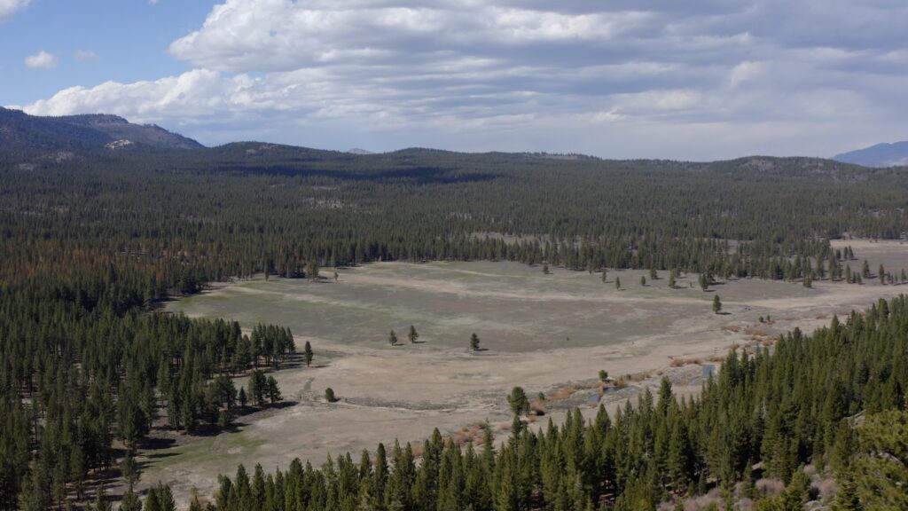
From there the road gets rockier as it winds through the trees. And eventually reaches Big Meadow where there’s a strange old wooden dam structure stretching across the meadow. From there, the road is long and bumpy and winding and ends at I-80 at Boomtown.
This trail is high enough that it is completely impassable every winter, though you may be able to get high enough in a dry year to make it worth a trip.
- Mileage: 24
- Difficulty: 5
- Time: 3 – 6 hours
- Season: Summer through fall
- Map: Hunter Lake Road, Gaia GPS
- Video: An after work run on the Hunter Lake Jeep Trail, Reno, Nevada
So those are my top ten easy off-road trails in the Reno area. Have you done any of those? Are they too easy? too hard? Did I miss your favorite? post a comment and let me know.
Happy Trails.


Add comment